sansibar pemba mafia 1 100 000 1 150 000

Sansibar - Pemba - Mafia. 1:100 000 - 1:150 000
This road map foldable into a practical format contains detailed information suitable for motorists and other travelers planning to visit the given country or area. The road map features symbols indicating notable tourist attractions and public transportation.
1160 Руб.
Italien. Superatlas 1:150 000 / 1:400 000
Italien. M 1:150 000 / 1:400 000. Крепление: двойная евроспираль.
1660 Руб.
Malaysia 1:800 000 / 1 100 000
his map appears in the map series world mapping project in travel expertise. Characteristic is the high-quality, clear and modern cartographic representation. Contour lines with elevation Coloured elevation levels Classified road network with distances Places of interest Detailed local index GPS-compatible With graticule
1044 Руб.
Montenegro/ 1:150 000
Montenegro. Crna Gora. Road + Leisure Map. 1:150 000 - tourist information - suitable for GPS - index with postal codes
593 Руб.
Kosovo 1:150 000
This map appears in the map series world mapping project in travel expertise. Characteristic is the high-quality, clear and modern cartographic representation. Contour lines with elevation Coloured elevation levels Classified road network with distances Places of interest Detailed local index
608 Руб.
Crete. 1:150 000
laminowana mapa turystyczna 1:150 000 format: 100 x 48 cm, po zlozeniu: 11 x 24 cm Dwustronnie laminowana, wygodna w skladaniu mapa turystyczna Krety bogata tresc turystyczna, m.in.: muzea, zabytki i inne interesujace obiekty (m.in. starozytne miasta, fortece, zamki, grobowce, swiatynie) szlaki turystyczne, kempingi, pola namiotowe parki narodowe, atrakcje przyrodnicze, winnice, gaje oliwne, lasy, zakrzaczenia cieniowanie plastycznie pokazujace uksztaltowanie terenu mapa zgodna z GPS - wspolrzedne geograficzne w ukladzie WGS-84 wszystkie nazwy w alfabecie lacinskim i greckim plany najwazniejszych miast: Chania, Rethymno, Iraklio, Agios Nikolaos, Sitia, Ierapetra
937 Руб.
Plattensee. 1:150 000
This road map foldable into a practical format contains detailed information suitable for motorists and other travelers planning to visit the given country or area. The road map features symbols indicating notable tourist attractions and public transportation.
548 Руб.
Peloponnesos. 1:150 000
Folded, fully indexed map of Peloponnesos and Corinth, Greece showing major roads, cities, districts, and political boundaries. Also details the locations of castles,ruins, museums, churches, archeological sites and various points of interest. Additionally, this map also has an insert containing historical and cultural information. Legend is in Greek, German, English, Italian, French, Spanish, Dutch, Czech, Slovak, Hungarian.
937 Руб.
Slovenia 1:150 000
Explore Slovenia with this Freytag&Berndt double-sided road map. The best way to plan your trip, prepare your itinerary, and to travel independently in this country. Top10 Tips: This map includes a Top10 of most interesting sights.
750 Руб.
Brazil. 1:2 000 000 - 1:3 000 000
Explore Brazil with this Freytag&Berndt double-sided road map. The best way to plan your trip, prepare your itinerary, and to travel independently in this country. Place name index in a booklet. Inset maps of Belem, Belo Horizonte, Brasilia, Sao Paulo, Rio de Janeiro, Fortaleza, Recife, and Manaus. Touristic information: airports, castles, ruins, churches, spas, car-ferries, natural preserve, lakes and rivers. The legend is in English, Brazilian, Spanish, Italian, German, Dutch, French, Czech, Slovak and Hungarian.
1231 Руб.
Sweden 1:1 000 000
Mapas y planos plastificados con un sistema propio, que logra un plegado muy sencillo y rapido. La cartografia que ofrece es muy atractiva y clara, incluyendo una completa toponimia, lugares de interes e indice en los planos.
743 Руб.
Afghanistan 1:1 000 000
This map appears in the map series world mapping project in travel know-how. Characteristic is the high-quality, clear and modern cartographic representation. - Contour lines with elevation - Coloured elevation levels - Classified road network with distances - Places of interest - Detailed local index - GPS-compatible - With graticule - Legend in four languages (Ger., Engl, French Polynesia, Span)
1164 Руб.

Botswana 1:1 000 000
This map appears in the map series world mapping project ™ in travel expertise. Characteristic is the high-quality, clear and modern cartographic representation. Contour lines with elevation Coloured elevation levels Classified road network with distances Places of interest Detailed local index
743 Руб.
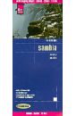
Zambia 1:1 000 000
This map appears in the map series world mapping project in travel expertise. Characteristic is the high-quality, clear and modern cartographic representation. Contour lines with elevation Coloured elevation levels Classified road network with distances Places of interest Detailed local index GPS capability by longitude and latitude UTM grid
608 Руб.
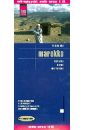
Marocco. 1: 1 000 000
This map appears in the map series world mapping project in travel expertise. Characteristic is the high-quality, clear and modern cartographic representation. Contour lines with elevation Coloured elevation levels Classified road network with distances Places of interest Detailed local index GPS capability by longitude and latitude UTM mark on the edge of the map
583 Руб.